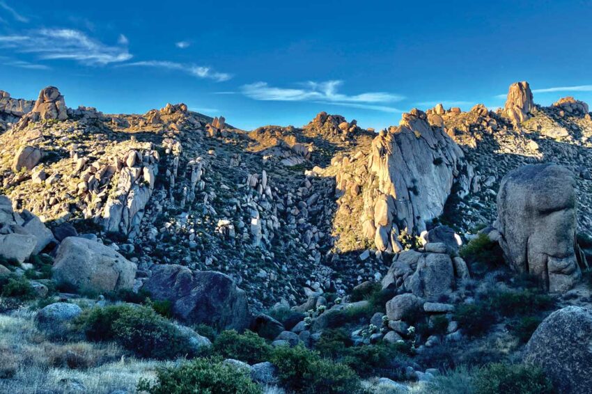
The McDowell Sonoran Preserve consists of an enormous network of multi-use trails, and the hike up to Tom’s Thumb is perhaps the most alluring one.
The protruding rock formation can be spotted from miles away, and may seem almost unattainable. But Tom’s Thumb Trail, which begins at the Tom’s Thumb Trailhead offers a very clear way up.

Rocky saguaro studded hillside along the East End Trail

Mighty saguaro off the Marcus Landslide Trail
The trail, rated difficult by the City of Scottsdale and moderately difficult by other sites like Alltrails, begins at an elevation of 2,813 feet at the trailhead and reaches 3,840 feet at Tom’s Thumb over the course of about 2.2 miles. The condition of the trail itself is surprisingly pleasant, and along the way up there are several points to stop and soak in the views–Harris’s Hawk Vista, Raven Roost Scenic View, Vulture View Scenic Point and Prairie Falcon Overlook. Beyond those points is a junction with the East End Trail, which could be considered for a significantly longer hike.
Continuing along Tom’s Thumb Trail to marker TT7, prepare to branch off to the right on a side trail that leads to Tom’s Thumb (there is signage for the side trail). (Note: If you miss that marker, there is no second chance elsewhere, so backtracking is a must.) Further along Tom’s Thumb Trail to the next marker (TL1), lies the opportunity to hike up Lookout Trail to The Lookout, which ends at an elevation of 3,858 feet. Tom’s Thumb Trail ultimately ends at the junction of Windgate Pass Trail at the marker TT17.
Fantastic views await at the top. Such close proximity to all the rock outcroppings and boulders provide a seemingly endless amount of eye candy, so it’s recommended to plan for a little extra time to enjoy at the top before heading back down.

Tom’s Thumb in portrait
Dogs are permitted on the trails, but it is strongly suggested that if it’s hotter than 90 degrees, it’s probably best to keep them home. Also, for those who enjoy riding electric bikes, please note that they are not allowed in any part of the McDowell Sonoran Preserve. Limited shade exists along the trail, so an earlier start allows for more benefit from shade before the sun breaks over the ridge to the east of the trail. Once at the junction of East End Trail, there’s little shade to be found. As always, its advisable to bring enough water, a cell phone and stay within your abilities.
Get There
Tom’s Thumb Trailhead
23015 N 128th St
Scottsdale, AZ 85262
Take Carefree Highway east to N. Scottsdale Road to Dynamite Boulevard and head east. From the corner of Pima Road and Dynamite Boulevard, it is about a 9-mile drive. From Dynamite Boulevard, head south on Alma School Road, east on Jomax Road, south on 118th Street, east on Ranch Gate Road and south on 128th Street to the trailhead. There’s plenty of signage along the way and restrooms at the trailhead,but no drinking water.
Story & Photos By Andreas Schmalz
[email protected]
Andreas Schmalz is a local Realtor® and an outdoor enthusiast who enjoys trail hiking, nature photography, and scenic drives throughout Arizona.

